Difference between revisions of "GENIE Gridspec Diagrams VerticalCoordSystem"
Genie-user (talk | contribs) |
Genie-user (talk | contribs) |
||
| Line 6: | Line 6: | ||
[[Image:space_based_type.png|center]] | [[Image:space_based_type.png|center]] | ||
| + | |||
| + | ''Note: the [[GENIE:Gridspec|gridspec overview]] contains introductory and background information on the gridspec; more detailed information can be found in Balaji's gridspec document on the [http://www.earthsystemcurator.org/index.php?option=com_content&task=view&id=38&Itemid=74 Earth System Curator] website.'' | ||
Revision as of 12:16, 22 February 2007
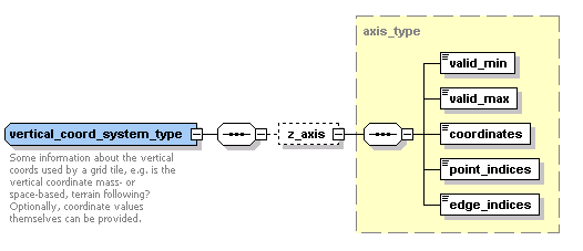
A vertical coordinate system provides a description of the vertical coordinates used by a grid tile, and may include the coordinates themselves. Coordinates are specified using an "axis" and are encoded in a similar way to the NcML "values" element -- either every coordinate can be listed, or a start value and offset given for periodic coordinates. "point_indices" and "edge_indices" are used in a similar way to indicate which coordinates refer to cell edges, and which to grid points.
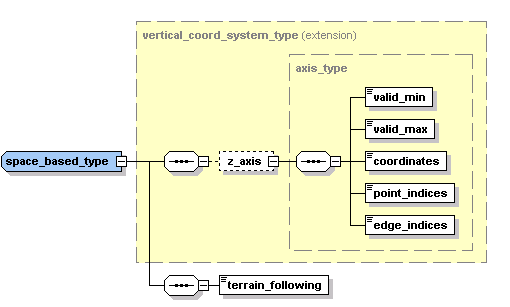
The vertical coordinate system has two sub-types, "mass_based_type" and "space_based_type", which can be used to give more information about the vertical coordinates; the latter is shown below.
Note: the gridspec overview contains introductory and background information on the gridspec; more detailed information can be found in Balaji's gridspec document on the Earth System Curator website.

